 Chapter 2
Climate Diagrams
Chapter 2
Climate Diagrams
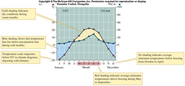
The above climate diagram shows temperature and rainfall trends through the
year at a site in Mongolia. Average
temperatures are below freezing
during the winter months and only above freezing from May through September.
Total precipitation is quite low, with most precipitation coming in summer
months, and yet due to warmer temps.
and higher evaporation, the summer
months are very dry. This site would be considered a cold desert.
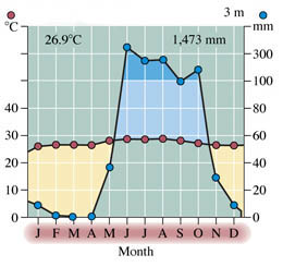
Climate diagram for Acapulco, Mexico. Average temperature is above
freezing and nearly steady
in all months (tropical climate), but the
precipitation is STRONGLY seasonal, with very little between
December and
April (dry season), but lots during the typical summer months. This would
be a tropical
dry forest habitat.
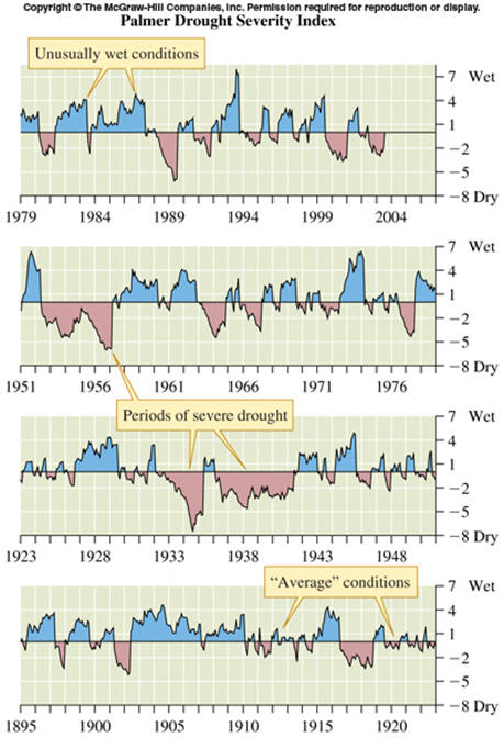
Climate versus weather in Manhattan, Kansas.
The above diagram shows yearly
departures from average precipitation from
1895 to 2007. Clearly indicated are
short and long periods of drought,
as well as short and long periods of wet conditions.
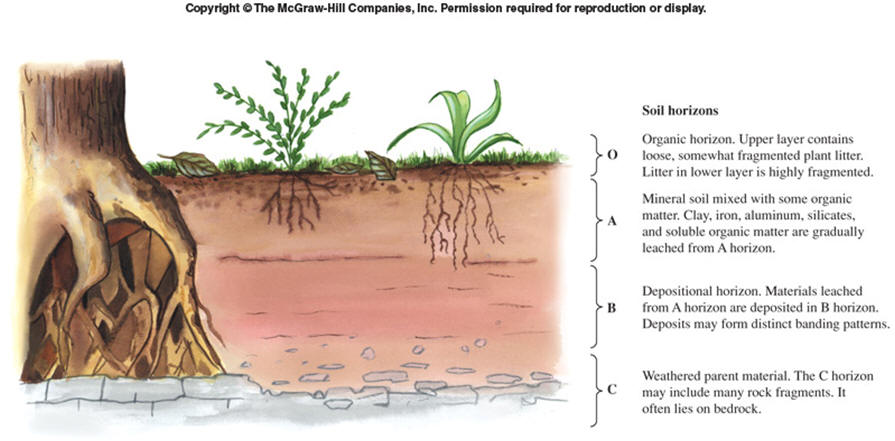
Soils -- the diagram below shows the different soil horizons from the surface downward: O, A, B, C. We will have a guest speaker in lab the first week (Gina Kertulis-Tartar) who will provided details on each layer including E and bedrock (not shown here).
BIOMES -- typically
characterized by the founding plant associations
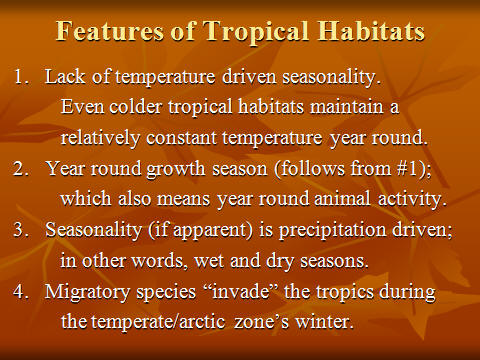
TROPICS -- What characterizes ALL tropical biomes? This will be
covered in class.

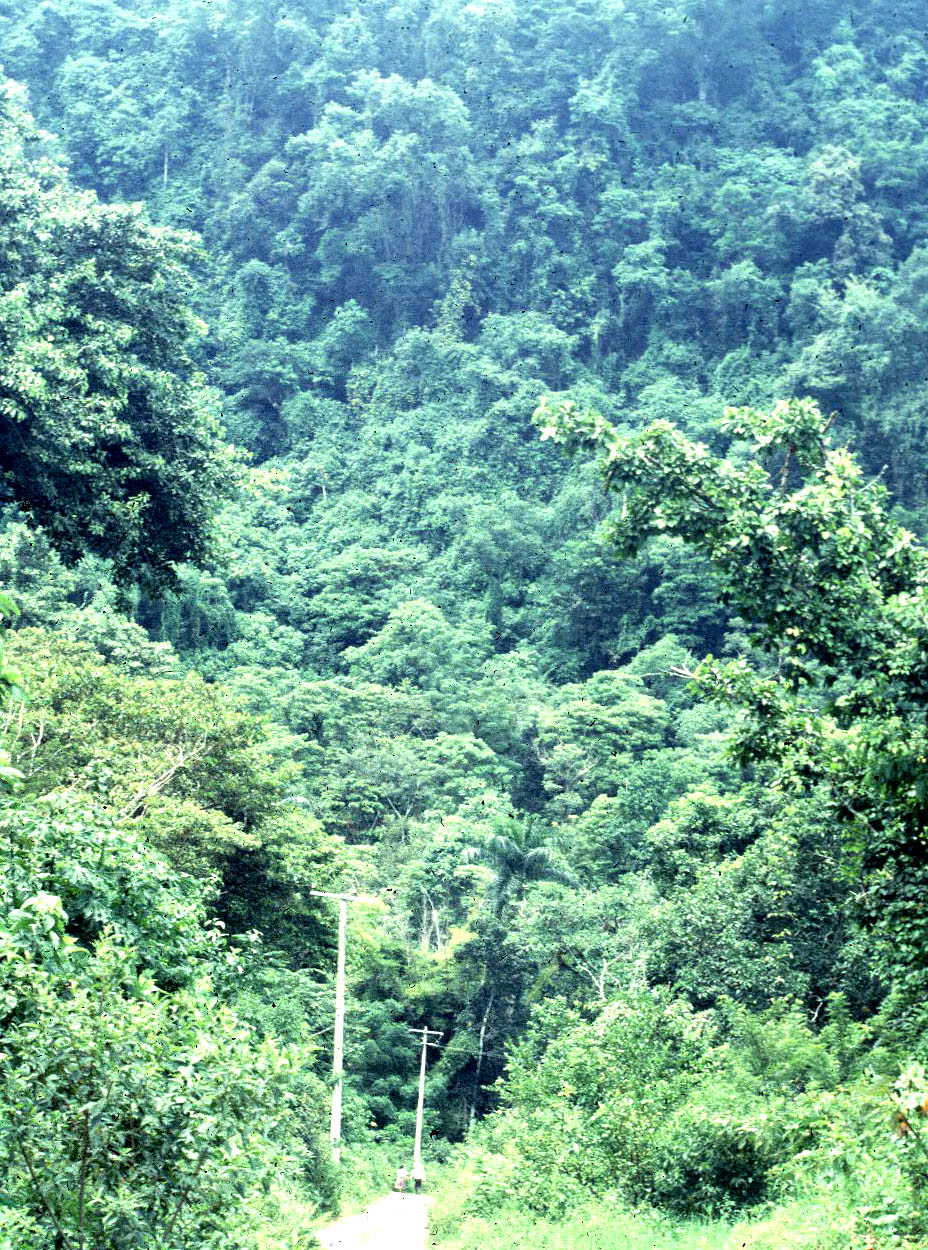
Tropical Rain Forest
Near Xilitla, San Luis Potosí,
Mexico
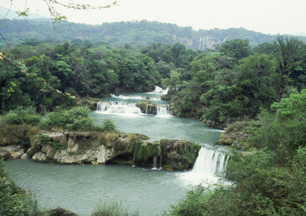
El Salto Falls, San Luis Potosí,
Mexico
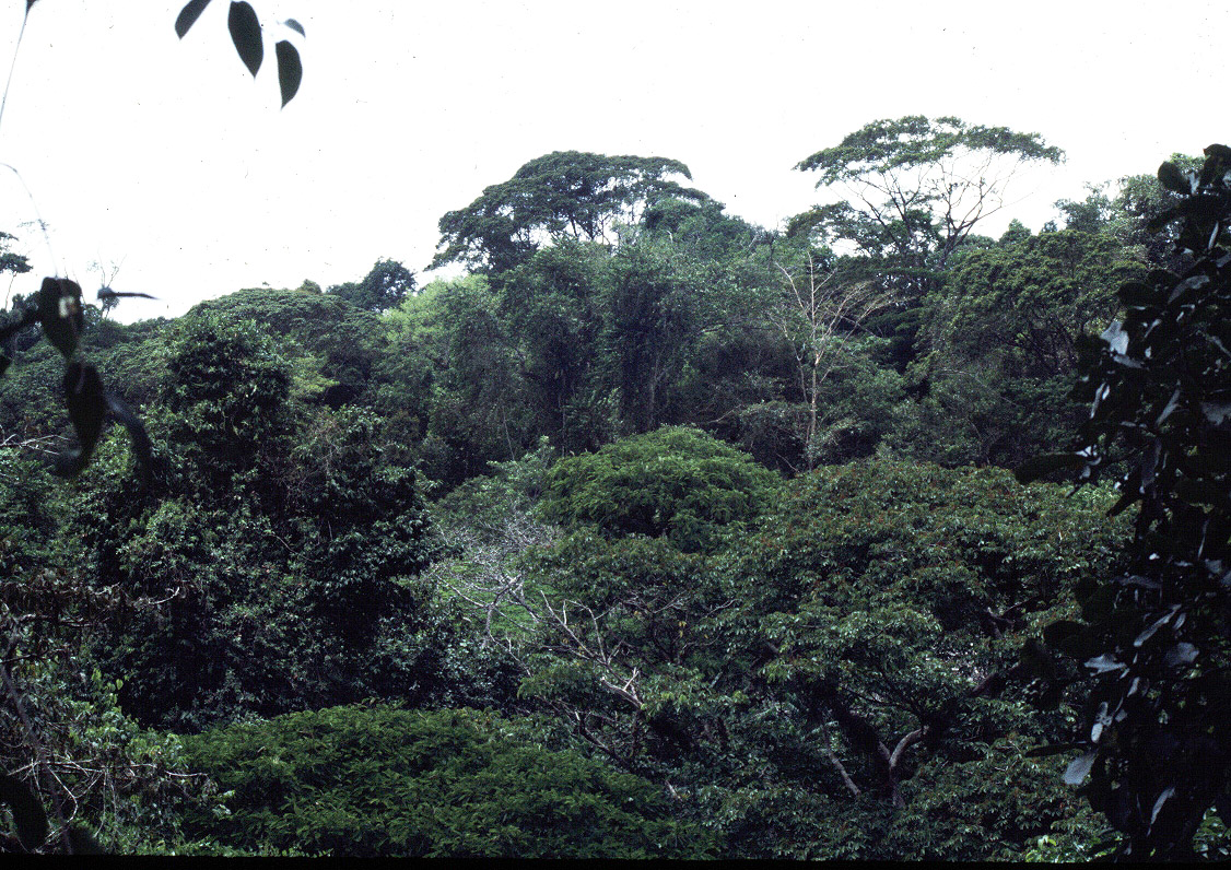
Canopy, with emergents, La Selva,
Costa Rica
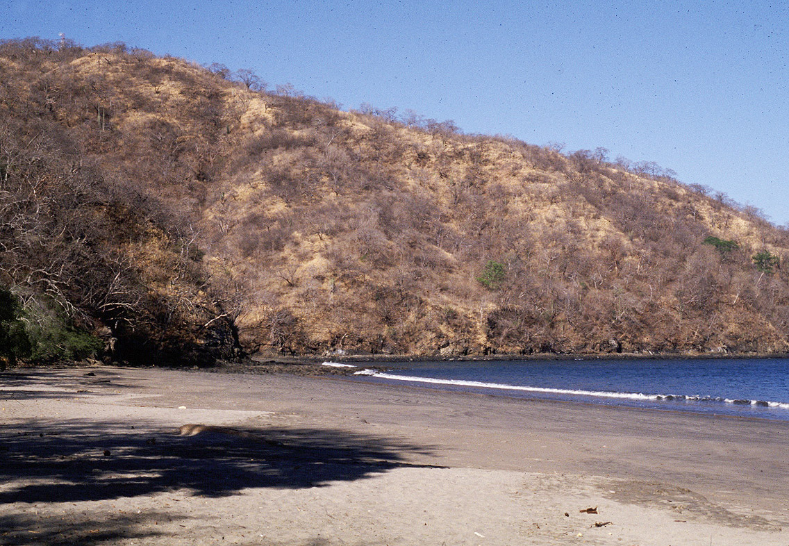
Tropical Dry Forest
Playa Hermosa, Dry Season,
Guanacaste Province, Cost Rica
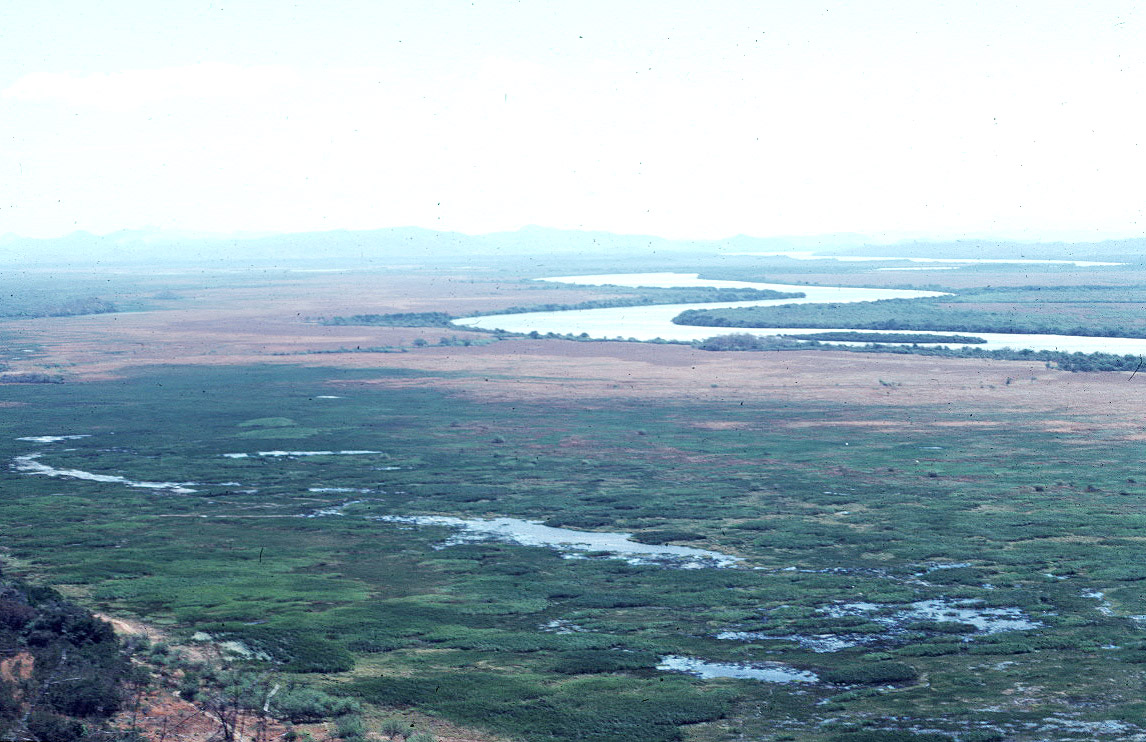
Tempisque Valley, Palo Verde
Science Station, Guanacaste Province, Costa Rica, Beginning of February (still
wet)
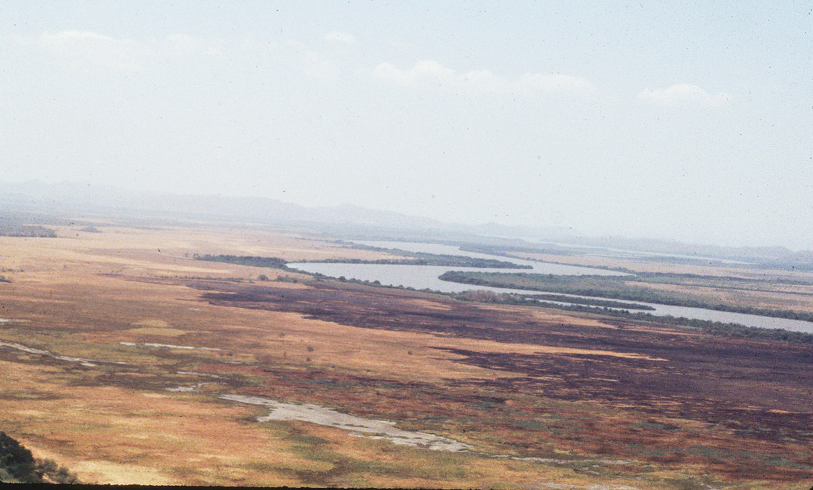
Tempisque Valley, Palo Verde Science
Station, Guanacaste Province, Costa Rica, Middle of April (quite dry)
Tropical Savanna -- Grasslands
Other tropical habitats
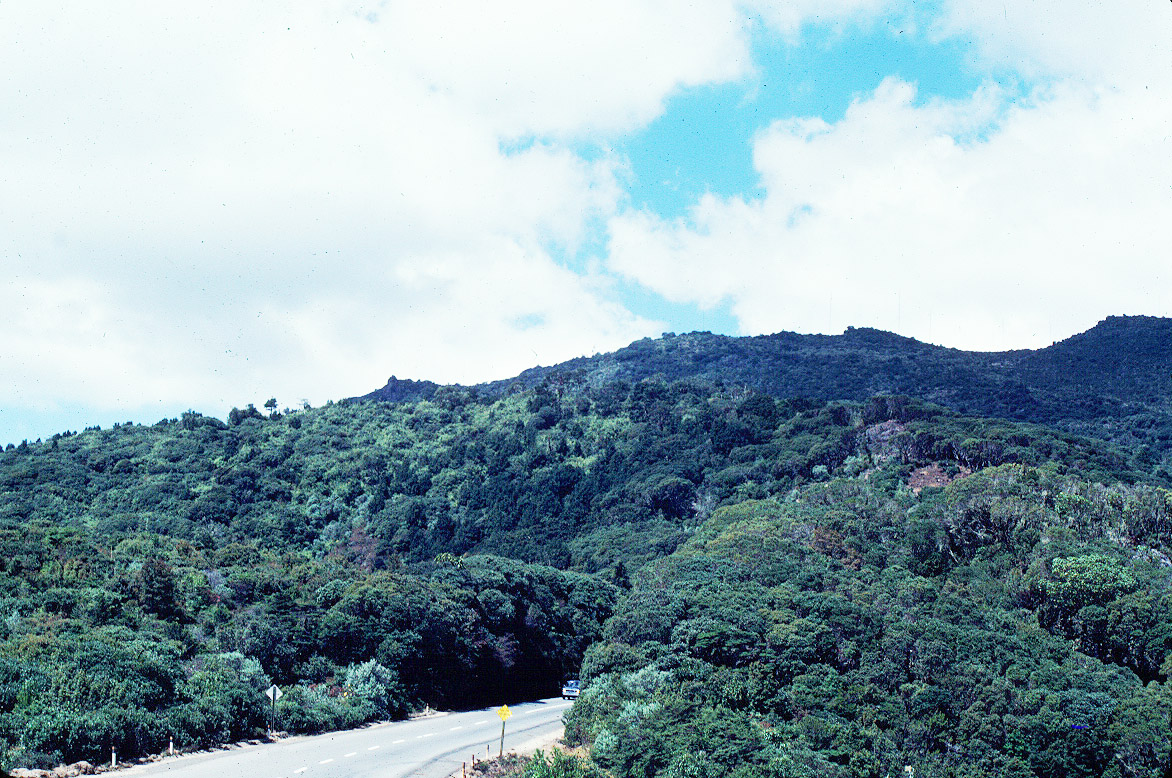
Mid elevation mixed forest --
Queretaro/San Luis Potosí border, Mexico 1600m
Paramo -- Cerro de la Muerte, Costa Rica, 3200m
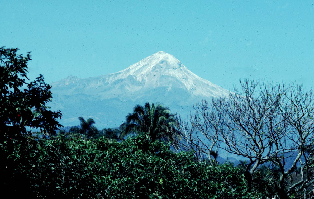
High elevation -- Volcan Citlatapetl, Mexico, with snow
So, What DOES characterize all
tropical biomes?
THE DESERT
Near Big Pine, eastern California (next two
pictures)
Looking south towards the Eureka Sand Dunes in eastern
California

TEMPERATE BIOMES
Mediterranean
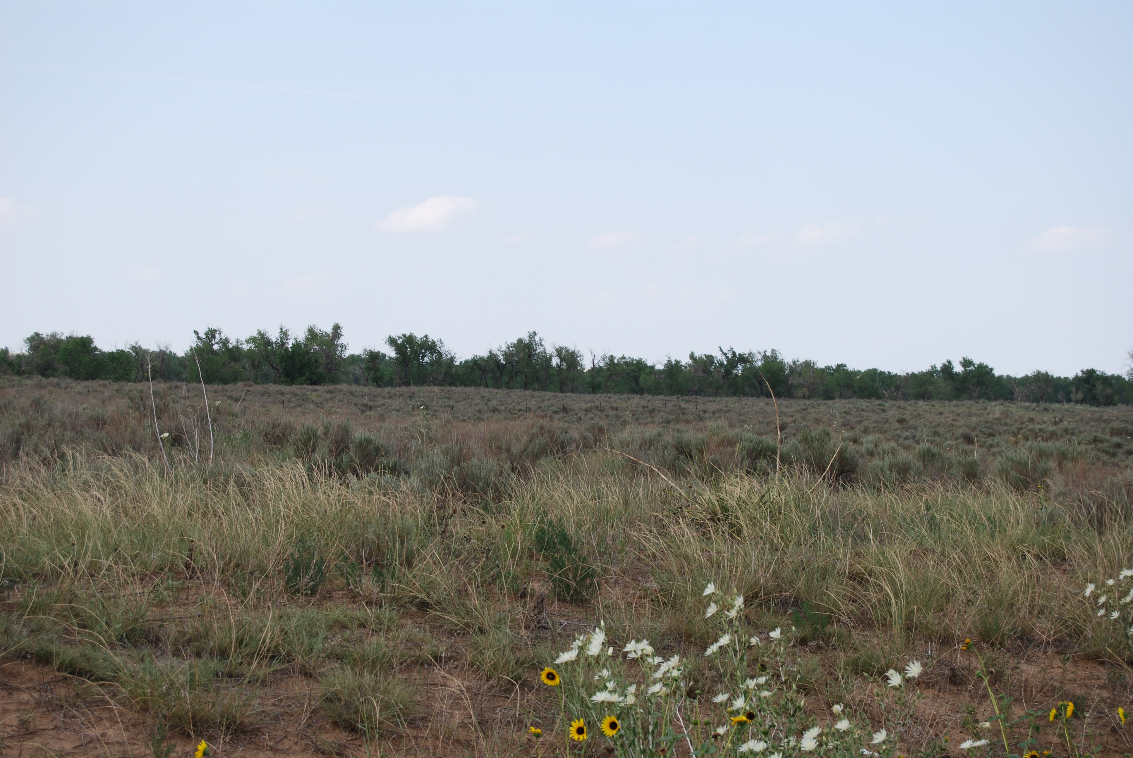
Grasslands
Cimarron National Grasslands,
Morton Co., Kansas
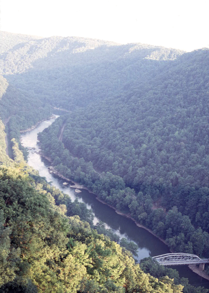
Forests
Mixed eastern deciduous
(hickory-oak)/pine forest -- north Georgia!
New River, West Virginia
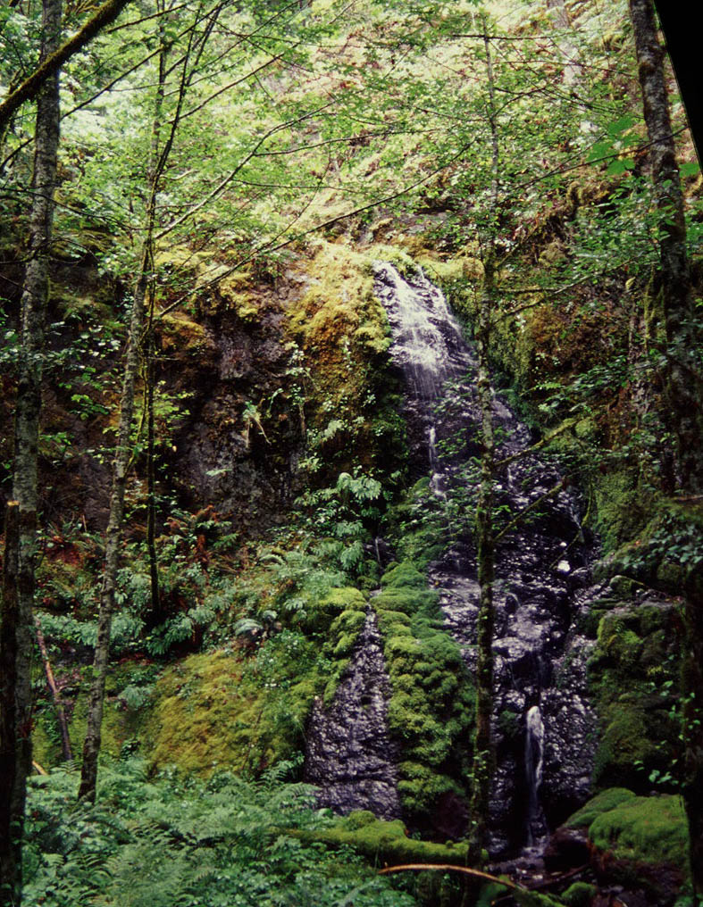
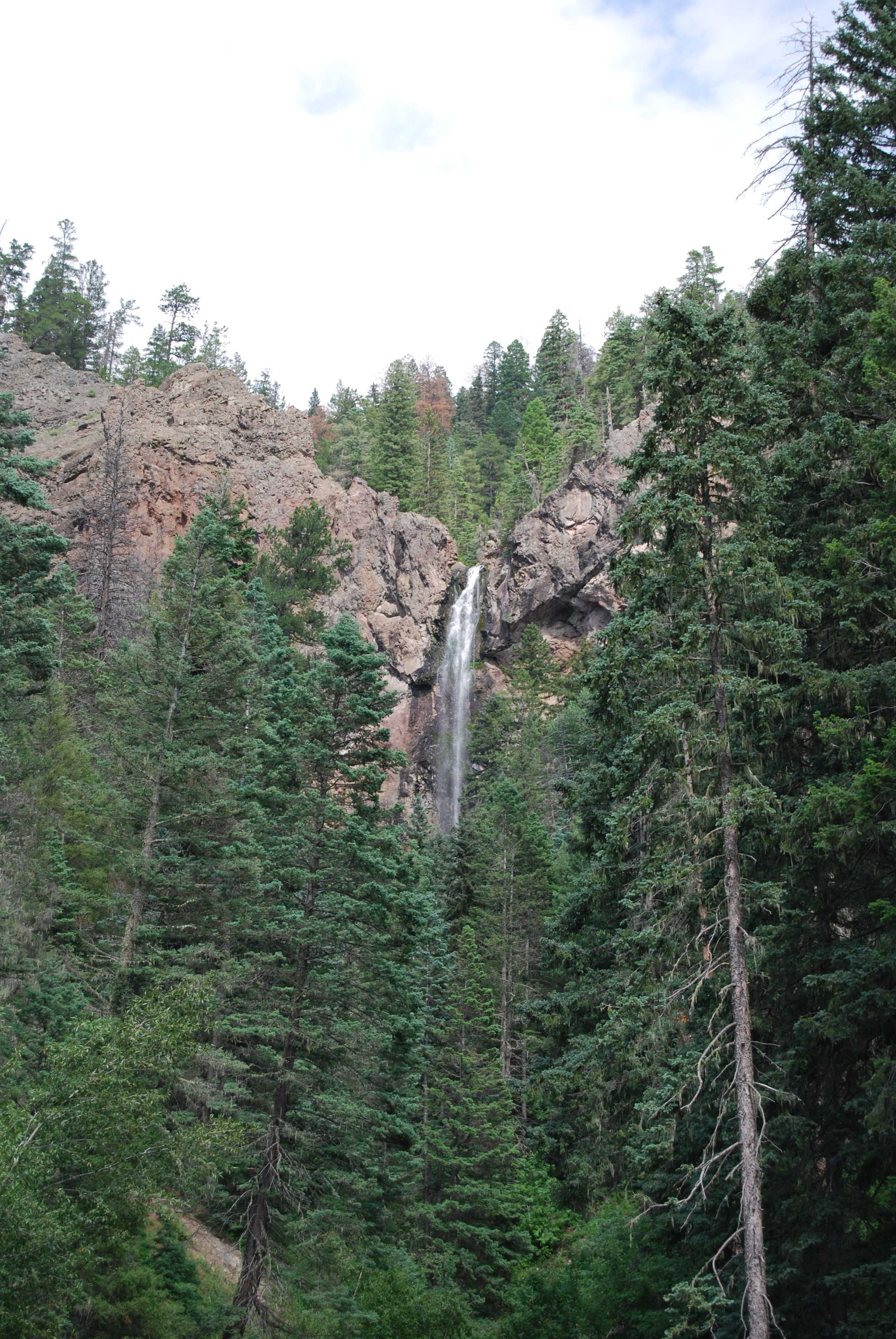
Temperate rain forest (how different
from tropical rain forest?)
Wolf Creek
Pass, Colorado (note lichens hanging from pine trees)
Oregon Cascades